Contents
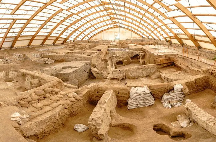
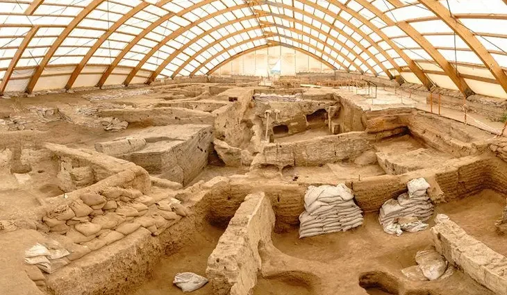
The UNESCO World Heritage site of Çatalhöyük, 41 kilometers southeast of the city of Konya, is one of the world’s oldest Neolithic sites.
During the 1960s, the excavations here, led by archaeologist James Mellaart, created worldwide headlines when the team announced the discovery of a large 9,000-year-old Neolithic settlement.
Hugely important in archaeological terms, the excavations here provide a window into the agrarian lifestyle of early Neolithic communities. It is especially notable for its massive size, the unique layout of its dwellings, and the settlement’s long duration.
Some 18 meters high and 12 hectares in area, the Çatalhöyük settlement mound is part of a much larger complex covering a total of 21 hectares, of which only about five percent has so far been excavated.
The date of the very earliest settlement here is claimed to be 6250 BCE, while traces of fire suggest that the last of the 10 settlements uncovered was abandoned around 5400 BCE.
The Çatalhöyük mound is just one of many places on the vast plains near Konya known to have been occupied between the 7th and 3rd millennia BCE. More recent sedimentation has since rendered many settlement mounds unrecognizable, and virtually the entire plains area has been brought under the plow. The earliest levels at Çatalhöyük now lie buried more than two meters below the surface of the surrounding plain.
Understanding Çatalhöyük
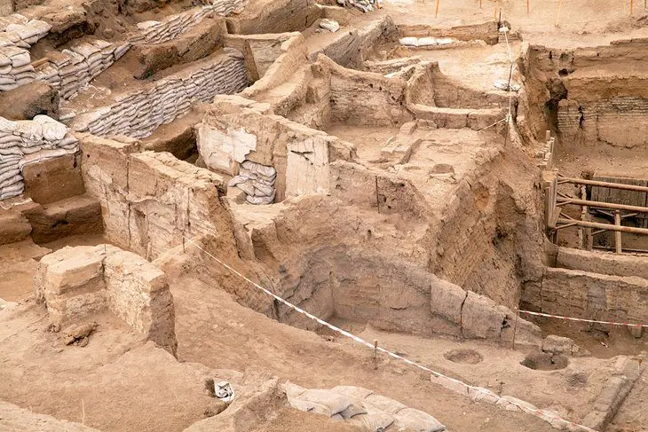
The dwellings excavated at Çatalhöyük were found to be remarkably similar in construction to traditional buildings still seen today. Only the layout of the settlement proved strikingly different.
The houses, each roughly 25 square meters in area, were flat-roofed, with a single living space and a storeroom. In addition to a bench, hearth, and oven, the rooms were furnished with platforms, presumably used for working and sleeping on but also for burials.
The dead were left in the open, outside the settlement, until scavenging animals had stripped the skeleton clean. Dressed in their clothes, they were then interred beside or under the sleeping platforms, continuing their participation, so to speak, in family life.
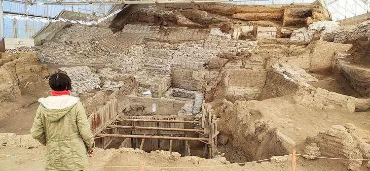
The settlement had no streets as such; the rectangular houses were close grouped in large blocks, with a courtyard serving here and there as a latrine and rubbish dump.
The houses were entered by a wooden ladder, American pueblo-style, via the smoke-hole. The floor was compacted mud; the walls mud-brick with mud, plaster, and lime rendering. Reeds were used to strengthen the roof, and sometimes there was a timber frame.
Amazingly, in view of the vulnerability of mud to weathering, some brickwork is still clearly recognizable. Fire must have fortuitously “baked” the bricks, hardening them and making them more weather resistant.
Myths and Art
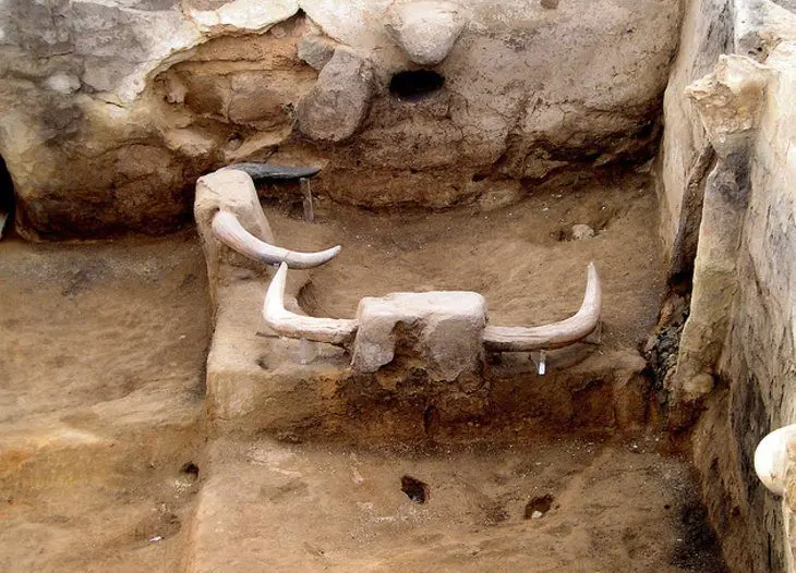
Çatalhöyük was evidently also the center of a religious cult, and many of the paintings, relics, and statuary unearthed during the excavation are now in Ankara’s Museum of Anatolian Civilizations, with a few pieces also on display in Konya’s archaeological museum.
Bulls’ heads and horns decorated nearly every house, suggesting a vigorous cult of the bull (hence also the name Çatalhöyük, meaning “antler mound”).
Clay figurines of obese goddesses would also indicate an active fertility cult, further evidence of which is found in some of the polychrome wall paintings. Other paintings include hunting scenes with men depicted as bulls, rams, or bears.
One of the most famous finds from Çatalhöyük (displayed in the Museum of Civilizations in Ankara) is a particularly striking wall mural purported to show Çatalhöyük itself below the outline of an erupting volcano, thought to be Mount Hasan in Cappadocia, which was still active at the time and permanently under the gaze of this Neolithic people.
The mural is sometimes claimed to be the world’s first map, though other experts dispute that the painting depicts the town and the volcano at all, and is instead more likely to represent a leopard skin.
The Site
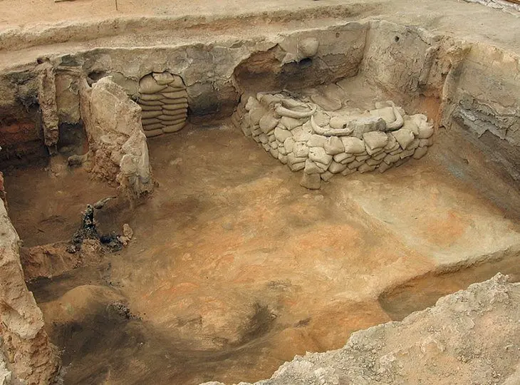
For visitors, the Çatalhöyük site is broken into three sections.
At the entrance, first have a peek into the experimental house, which was created by the archaeologists at the site to recreate the mud-brick architecture of the Neolithic village. This allows you an inkling of what daily life may have been like here in the settlement.
Next door is a small museum with good explanations about Çatalhöyük, as well as displays of small finds from the site.
A path from the museum leads across the plains to the settlement mound, prominently topped by the protective roof of the North Shelter. Underneath the roof is an excavation site, where you can easily make out the shapes of Neolithic housing.
From here, take the trail to the South Shelter, which is the most important section of the site in archaeological terms. It was here that archaeologists found most of the artistic objects that made Çatalhöyük famous.
Practicalities
Çatalhöyük is on the southern edge of the village of Kuçukköy, which is 41 kilometers southeast of Konya. Public transport is sparse in this area, so most visitors who don’t have their own vehicle take a taxi trip here from Konya.
Most taxi drivers in Konya know where the site is and are more than willing to negotiate a return trip price (including waiting time).
You could also combine a visit to Çatalhöyük with visits to other attractions in the Konya area, such as the rock-cut churches of the village of Gökyurt (109 kilometers west of Çatalhöyük and 48 kilometers southwest from Konya). If you’re not self-driving, you can book this taxi day trip through your hotel.
Official site: http://www.catalhoyuk.com/
More Related Articles on PlanetWare.com
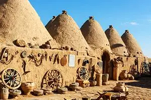
More History: Turkey’s most famous historic sites, such as the vast Roman ruins of Ephesus, are scattered along the coast, but inland there is plenty more to discover. Gordion is where Alexander the Great sliced through the Gordion knot. Mount Nemrut is known for the eerie, giant toppled statues that sit on its summit, and Sanliurfa is where you head to visit Göbeklitepe, home to the world’s oldest temple, and Harran, with its beehive-style houses and Ummayad ruins.


