Contents
- 1. Radnor Lake Trail in Radnor Lake State Park
- 2. Harpeth Woods Trail in Edwin Warner Park
- 3. Mossy Ridge Trail in Percy Warner Park
- 4. Shelby Bottoms Trail at Shelby Bottoms Greenway
- 5. Stones River Greenway of Nashville Trail
- 6. Volunteer Trail – Day Loop at Long Hunter State Park
- 7. Couchville Lake Arboretum Trail at Long Hunter State Park
- 8. Bryant Grove Trail at Long Hunter State Park
- 9. Richland Creek Greenway
- 10. Sedge Hill Trail at Beaman Park
- 11. Bells Bend Loop Trail
- 12. Narrows of the Harpeth at Harpeth River State Park
- 13. Montgomery Bell Trail at Montgomery Bell State Park
- Map of Hiking Trails near Nashville, TN
Hiking might not first come to mind when thinking about things to do in Nashville, but there are plenty of options for stretching your legs in and around the city. Among the most popular and accessible green spaces for hiking trails are Percy and Edwin Warner Parks (aka the Warner Parks), located just a few miles from downtown.
The city has an impressive network of trails organized under the banner of “greenways.” Three of these greenways are featured on our list of best hiking trails: Shelby Bottoms, Stones River, and Richland Creek. For non-urban hiking options, consider getaways just outside the city, such as Beaman and Bells Bend Parks.
Within a 30- to 45-minute drive from Nashville, visit the four state parks on our list for more options to hike while communing with nature. Take in the stunning geology (limestone cliffs and sinkholes) and sparkling waterways (lakes, rivers, and creeks). Embrace each encounter with wild creatures and birds, always more abundant whenever intrusive human activities are kept to a minimum.
Imagine if you could click your heels together and be transported to another world. Our list of the best hiking trails near Nashville will help you get there.
1. Radnor Lake Trail in Radnor Lake State Park
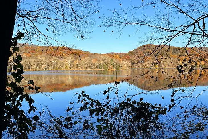
Radnor Lake Trail is an easy hike accessible by an all-terrain wheelchair. The trail enables hikers to circumnavigate the lake on a mostly flat loop covering around three miles. Crossing wooden bridges and wandering in the shade of forested portions, Radnor Lake Trail is good for all skill levels. Accessible year-round, the trail is used for hiking, running, and bird-watching. Add 1.4-mile South Cove Trail and 1.65-mile Ganier Ridge Trail for considerably more challenge.
Of all the state parks near Nashville, Radnor Lake State Park is the closest—about 12 miles away near Brentwood. There are eight miles of trails in this day-use park, covering a range of terrain (easy to difficult) and scenery (lakeside to steep hills). Hikers, photographers, and people viewing birds and wildlife are allowed on the trails. Pets, cyclists, and joggers are only permitted on Otter Creek Road. Radnor Park is home to owls, herons, coots, mink, and otters.
At the trailhead, make a stop at Walter Criley Visitor Center. In addition to restrooms and natural history exhibits, you can obtain the local bird checklist and trail maps. The center also supports environmental education programs conducted by park rangers about what you might experience out on the trail.
Address: 1160 Otter Creek Road, Oak Hill, Tennessee
2. Harpeth Woods Trail in Edwin Warner Park
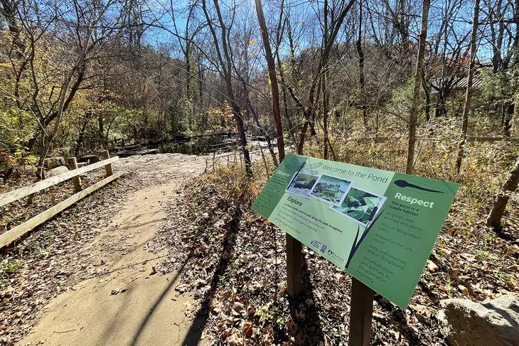
Harpeth Woods Trail is one of three designated trails in the 626-acre Edwin Warner Park. This 2.5-mile moderate, forested loop trail has a slight elevation of 350 feet. The trailhead is conveniently accessed from the parking lot at the Warner Park Nature Center. Here, you will meet locals who use this popular route for daily walks and runs. The nature center also organizes guided hikes year-round on this trail and others in the park.
When picking up a free trail map at the nature center, spend time exploring the center’s fascinating wildlife exhibits. Learn about the trees and plant life you will see on your hike. This is a lovely place to enjoy a picnic before or after your hike. Restrooms and drinking water are available.
Start out on the Nature Loop Trail and follow the blue markers to the Harpeth Woods Trail. A rich variety of trees are seen along the path, including mature cedar, oak, and beech.
The first portion of the trail is the most strenuous, so reward yourself by taking a break halfway around the loop beside the Little Harpeth River. On your return, watch for evidence of a small rock quarry that dates to the 1930s, when public works used stone for road building in the park. The last stretch of the trail takes you along a straight, flat corridor that is part of the historic Natchez Trace byway.
Address: Warner Park Nature Center, 7311 Highway 100, Nashville, Tennessee
3. Mossy Ridge Trail in Percy Warner Park
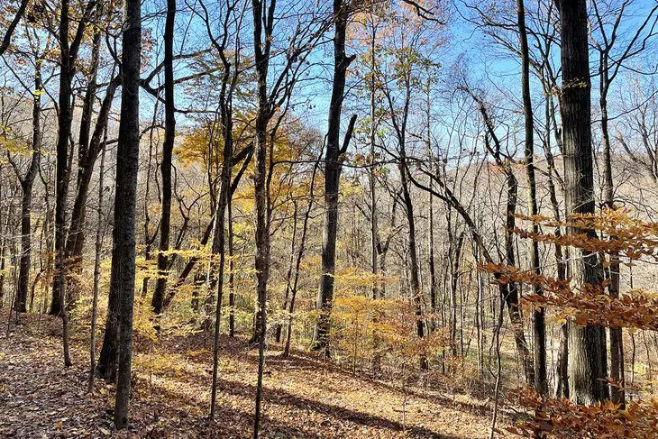
Located in Percy Warner Park, Mossy Ridge Trail is a 4.5-mile moderate loop that can be accessed by the easy one-mile Cane Connector Trail from the Warner Park Visitor Center. The one-mile Cane Connector leads you from Edwin Warner Park into Percy Warner Park. With its 2,060 acres and 10 trails, Percy Warner Park offers hiking, equestrian, and biking trails.
Mossy Ridge Trail is five miles of mostly shaded up-and-down terrain with an elevation gain of roughly 900 feet. It features a moss-covered forest, steep ascents, natural springs, and open meadow areas. Benches are available for resting and reflecting as you make your way along the trail. A small waterfall adds some nice scenery to the hike.
Address: Warner Park Nature Center, 7311 Highway 100, Nashville, Tennessee
4. Shelby Bottoms Trail at Shelby Bottoms Greenway
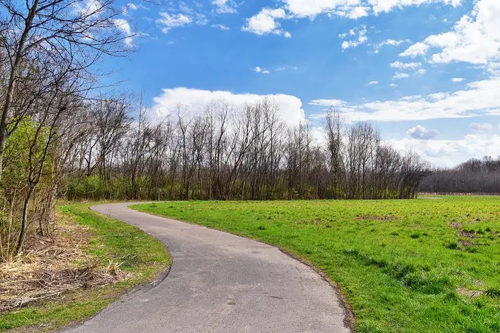
Shelby Bottoms Trail is one of the most popular places to connect with nature in Nashville’s network of greenways throughout the city. This paved greenway trail is mostly flat with marginal elevation gain, and spans more than five miles. The trail is popular because of its scenic route along the Cumberland River. Not only a favorite for people who like to walk, the trail gives visitors access to active bird-watching in this rich riparian zone.
Towards the northern end of the trail, Shelby Bottoms connects with Stones River Greenway at the photogenic Cumberland River pedestrian bridge. The main trailhead is closer to downtown at Shelby Bottoms Nature Center, which provides trail maps and interpretation about local natural history.
To cover the entire distance of the trail or include connecting greenway trails into your plans, consider renting a bike from Nashville BCycle station at the nature center. The Shelby Bottoms Trail is suitable for people in wheelchairs and parents walking with a stroller.
Address: Shelby Bottoms Nature Center, 1900 Davidson Street, Nashville, Tennessee
5. Stones River Greenway of Nashville Trail
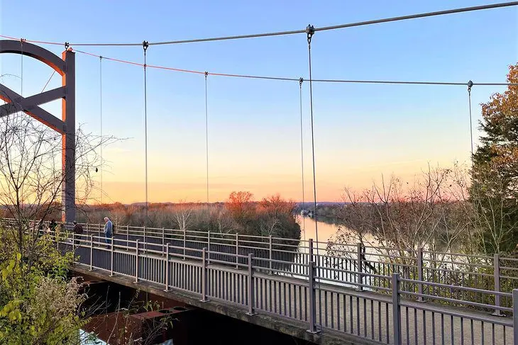
Stones River Greenway of Nashville Trail is located 12 miles east of downtown and follows Stones River for much of its 10.7-mile one-way route. Hop on and off this trail at several trailhead access points and parking areas. It’s a multi-use trail, so you can choose to walk or cycle its paved surface.
This trail is the longest segment of the Nashville Greenway system. The trail runs from the scenic Cumberland River pedestrian bridge (where it connects to Shelby Bottoms Greenway) and ends at Percy Priest Dam and Lake—the large reservoir southeast of the city. Enjoy the combination of shade and open sky.
Hiking with Fido? This pet-friendly trail takes you past Two Rivers Park, which is home to a popular dog park.
6. Volunteer Trail – Day Loop at Long Hunter State Park
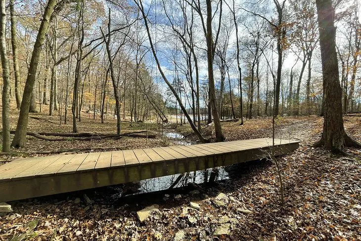
Located within half an hour of Nashville, Long Hunter State Park is a popular hiking destination with 25 miles of trails. A favorite hike is Long Hunter’s Volunteer Trail – Day Loop. This easy-to-moderate 4.5-mile loop connects to a one-way spur that takes you to a primitive campsite on J. Percy Priest Lake. It begins on the Volunteer Trail but then breaks off into its own hike to ultimately form a loop.
The Volunteer Trail Day Loop is a popular choice that skirts the lakeshore. The scenery rewards you with water views from bluffs overlooking forests of cedar and oak. Don’t be surprised if you see deer on the way, and if you’re really lucky, a fox or bobcat. Pileated woodpeckers, osprey, and hawks make their home here, and common loons are seen on the lake. Enjoy the grand mix of limestone formations with shoots of prickly pear, forested hills, creeks, and Nashville’s largest lake.
Leashed dogs are allowed on this trail.
Address: 1650 Granny Wright Lane, Hermitage, Tennessee
7. Couchville Lake Arboretum Trail at Long Hunter State Park
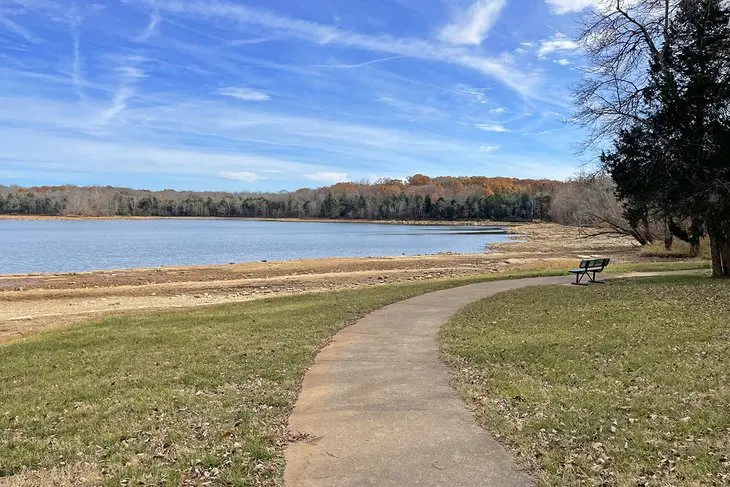
Couchville Lake Arboretum Trail is the easiest trail to walk in Long Hunter State Park. This two-mile paved loop gives you access to the scenery all along the lakeshore on foot or by wheelchair. Watch for white-tailed deer in the forest and mink on the shoreline from one of the fishing platforms.
Bird-watchers and photographers will delight in seeing wild turkeys, herons, and osprey. Plants and trees in the arboretum—the first to be certified in a Tennessee state park—are identified along the way. Learn about southern trees, such as sycamore and sassafras, of which 42 species are labeled and identified on the trail.
Address: 2910 Hobson Pike, Hermitage, Tennessee
8. Bryant Grove Trail at Long Hunter State Park

Bryant Grove Trail in Long Hunter State Park is eight miles round trip. Your four-mile turnaround point is one of the rare swimming areas in Long Hunter State Park. The trail is rated easy to moderate with a 218-foot elevation gain.
This flat, winding route connects the dots between J. Percy Priest Lake and Couchville Lake. Pets aren’t allowed on this mixed forest and meadow trail, so chances are good you’ll see birds and wildlife. Prickly pear cactus grows here, along with wildflowers such as the perennially gorgeous coneflower. You’ll also go through several distinctive habitats, including unique limestone glades.
Address: 2910 Hobson Pike, Hermitage, Tennessee
9. Richland Creek Greenway
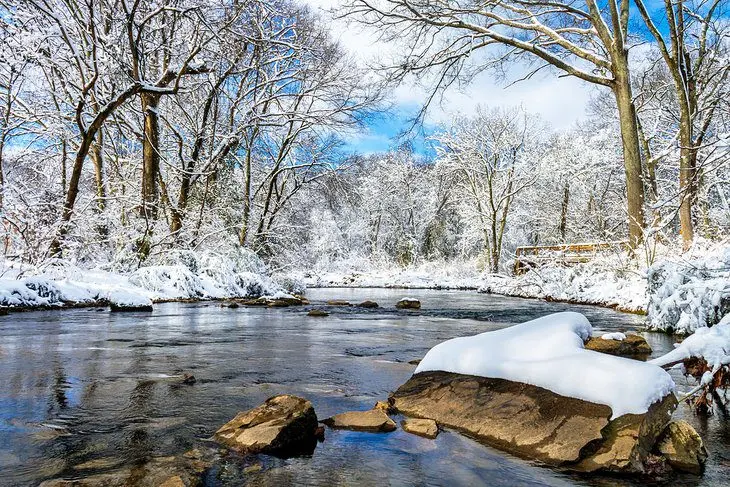
Richland Creek Trail is a popular fitness walk that can be done by hikers, walkers, joggers, and cyclists—often all at once, so pick your time to avoid congestion.
Accessible year-round, the Richland Creek Greenway trail is comprised of three sections. This includes the 1.1-mile West Park loop; the one-mile England Park segment; and the 4.2-mile McCabe Park portion, which links McCabe Park with the Sylvan Park neighborhood. Look out for the historical marker for Dutchman’s Curve—the site of a major train accident in 1918.
If you need a rest or respite from the sun, there are benches along the way and shady areas.
Address: West Park, 6105 Morrow Road, Nashville, Tennessee
10. Sedge Hill Trail at Beaman Park
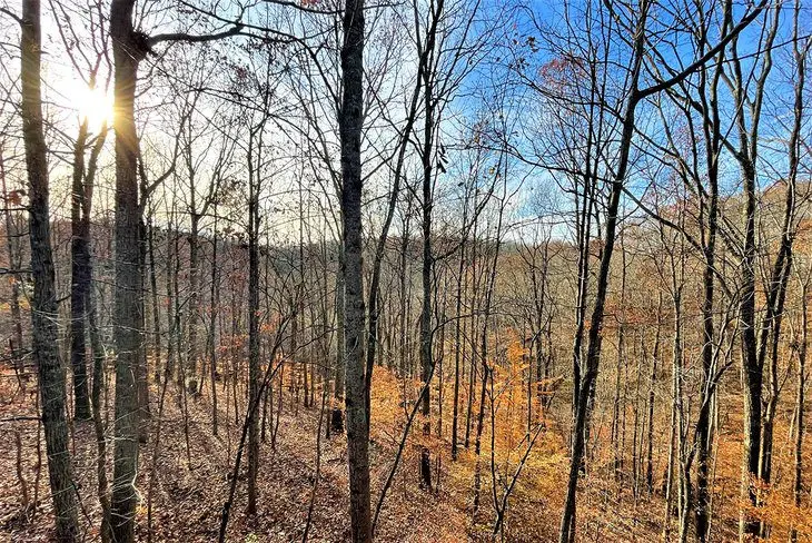
Sedge Hill Trail is a short 1.2-mile round-trip energetic hike in the woods that drops from Beaman Park Nature Center along Henry Creek to Little Marrowbone Creek. If you wish to extend your hike, take the two-mile Henry Hollow Loop. Otherwise, turn around and complete 242 feet of elevation to the nature center. Enjoy the center’s nature exhibits and relax in an Adirondack chair on the deck looking into the forest canopy.
Beaman Park comprises 2,370 rugged acres, with almost 15 miles of designated hiking trails. These trails are less busy than hiking areas in the city, yet the short trek to the country delivers so much more in terms of scenery and serenity. If you have time for more hiking, continue south on Old Hickory Blvd to the open pasturelands of Bells Bend Park.
Leashed dogs are permitted to join you on this hike.
Address: Beaman Park Nature Center, 5911 Old Hickory Blvd., Ashland City, Tennessee
11. Bells Bend Loop Trail
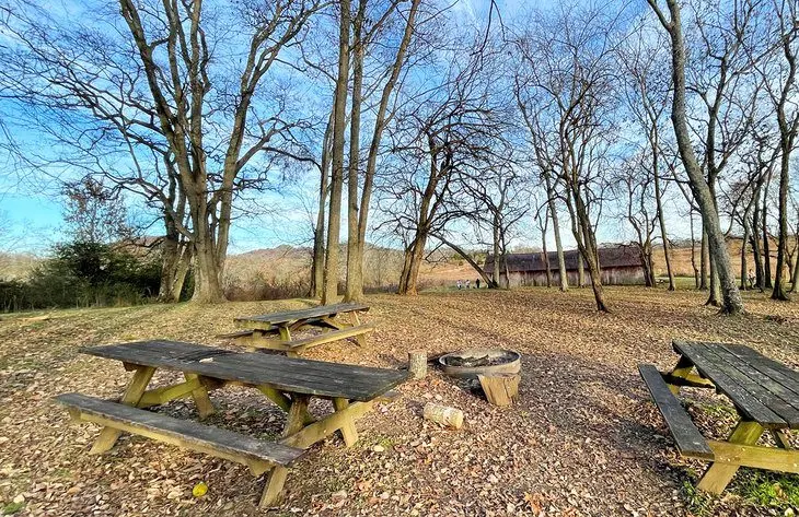
Bells Bend is an 808-acre pastoral park west of Nashville named for a bend in the Cumberland River. The 2.3-mile loop trail is rated easy with a 213-foot elevation gain. Be aware that much of the terrain is a meadow with little shade, so go early or late on a hot day. Take your leashed dog, but monitor your canine friend for ticks.
Enjoy the comfortable chairs and view from Bells Bend Outdoor Center when you complete your walk. The center features a demonstration garden and outdoor mini climbing wall to safely practice hand and foot holds. The property includes the historic Buchanan House, built in 1842, and a primitive tent site. Start your hike at the nature center, which is equipped with restrooms.
Address: Bells Bend Outdoor Center, 4187 Old Hickory Blvd., Nashville, Tennessee
12. Narrows of the Harpeth at Harpeth River State Park
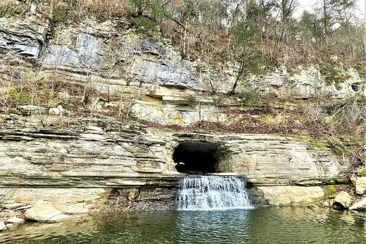
Harpeth River State Park, located 26 miles west of Nashville, is well worth the drive to see the scenic combination of river and limestone. This combo is especially striking at one of the most popular trails, the Narrows Trail.
Short and sweet at one mile long and 223 feet elevation, this easy-to-moderate trail features rock formations. Most famously, a waterfall emerges from a man-made hole in the rocks. This is the former site of the Montgomery Bell Pattison Forge.
Take a short 0.3-mile spur up the limestone Bluff Overlook Trail for a panoramic view of the Harpeth River Narrows.
Address: 1254 Narrows of the Harpeth Road, Kingston Springs, Tennessee
13. Montgomery Bell Trail at Montgomery Bell State Park

Montgomery Bell Trail, 10.4 miles long and located at a state park of the same name, has an elevation gain of more than 1,000 feet and is rated moderate. Once you have completed the entire loop, you will have seen most areas of the park and many of its natural features.
After leaving your vehicle at the park visitor center, the trail will lead you to stream crossings, waterfalls, three lakes, an 18-hole golf course, and a historic log cabin.
Montgomery Bell State Park is located 38 miles west of Nashville. Consider an overnight stay before or after your hike in one of eight deluxe cabins, or a room in the lodge that has a restaurant and other resort amenities. The 100-plus-site campground is an attractive option for provisioned hikers.
Address: Montgomery Bell State Park, 1020 Jackson Hill Road, Burns, Tennessee


