Contents
- 1. College “M” Trail
- 2. Drinking Horse Mountain
- 3. Peets Hill, Burke Park
- 4. Storm Castle Peak
- 5. Bear Trap Canyon National Recreation Trail
- 6. South Cottonwood Trail
- 7. Beehive Basin Trail
- 8. Triple Tree Trail
- 9. Glen Lake Rotary Park
- 10. Madison Buffalo Jump State Park
- Map of Hiking Trails near Bozeman, MT
- Best Time to Go Hiking in Bozeman
Author Brad Lane lived in Montana between 2018 and 2021 and enjoyed hiking near Bozeman.
Bozeman is a university city in the mountainous region of Southwest Montana with a big hiking appeal. The sprawling Custer Gallatin National Forest surrounds the town, and inviting public parks stem from the city streets. Several quintessential Montana hiking trails spiderweb throughout these wide-open spaces.
The Gallatin Valley Land Trust maintains several excellent in-town routes within their “Main Street to the Mountains” trail network. This ever-expanding network has family-friendly hikes, great sunset routes, and endless connecter trails for all-day adventures.
Classic Montana landscapes await outside city limits within the surrounding national forest. This lodgepole pine-infused landscape has more hiking trails than days in the year. From high-mountain pursuits to leisurely creekside ambles, every hike in Custer Gallatin offers a postcard adventure.
Discover a memorable Montana adventure with our list of the top hiking trails near Bozeman.
1. College “M” Trail
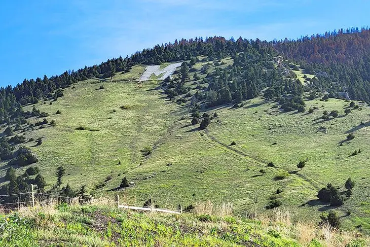
The College “M” Trail is one of the most popular hiking trails in Bozeman. It’s at the mouth of Bridger Canyon on the northeast side of town, and the large “M” on the mountainside represents the hometown of Montana State University. And it serves as a beacon to those interested in a hike. What makes the route so popular is its access, relative ease, and high return on views.
Hikers have two options to ascend to the “M.” From the trailhead, a steep path to the right takes a more direct approach, while the trail to the left offers a more winding and less steep route. Choose your own adventure at the beginning here, with both routes climbing over 700 feet to the “M.” For a round trip, expect to traverse between two and three miles.
Because of its relative ease and proximity to town, the College “M” Trail is very well-trodden. It’s popular for quick mountain exercise and first-time hikes for visiting friends and family. Arrive early at the parking area if you’re hoping for a spot close to the trailhead.
Or, if the parking lot is full, the trailhead for Drinking Horse Mountain is across Highway 86, with extra parking spots and a pedestrian tunnel. Expect crowded parking lots throughout the summer, sometimes filling before noon.
Read More: Top-Rated Attractions & Things to Do in Bozeman
2. Drinking Horse Mountain
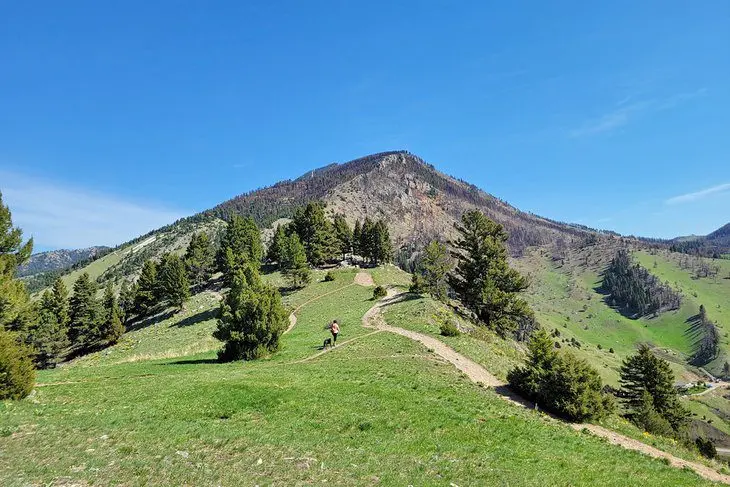
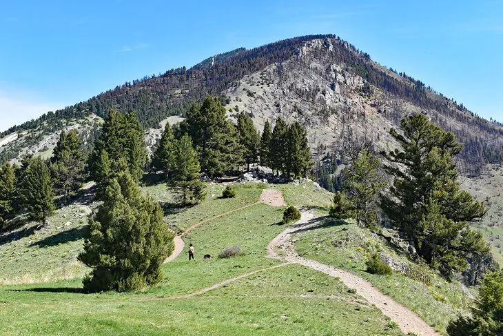
Drinking Horse Mountain is a National Recreation Trail across Highway 86 from the popular College “M” Trail. It offers a scenic 2.2-mile, figure-eight loop with benches and several scenic viewpoints along the way. Because of its relatively short length and rewarding views, it’s a popular trail for families and first-time hikers.
Seasoned trekkers also appreciate the bountiful landscapes offered by the trail. With 700 feet of elevation gain, the trail tops out with alpine terrain, sometimes filled with wildflowers. This elevation affords an excellent view of the Gallatin Valley and the Bridger Mountains nearby.
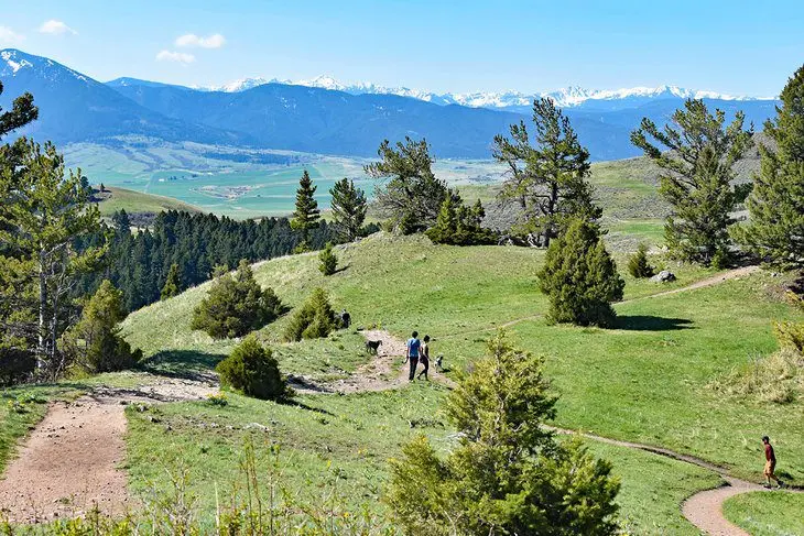
The figure-eight loop construction of the trail leads to a choose-your-own-adventure with regard to steepness. The trail begins by crossing a scenic bridge over Bridger Creek, and then users can take the steeper or more winding route to the top. Plan for some extra time to enjoy the views at the summit.
3. Peets Hill, Burke Park
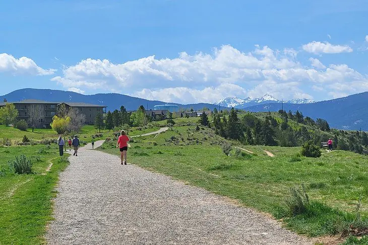
Burke Park, off Main Street east of downtown, is one of the most popular in-town hiking trails. The outdoor space is also known as “Peets Hill,” and it blends with the surrounding city, making it easy for impromptu excursions. It features a short climb and a flat hike on a plateau overlooking the countryside. This elevated landscape makes Peets Hill particularly popular for sunset hikes.
Most users access the trail somewhere along Church Street, a few blocks south of Main Street. The Bozeman Public Library also lends access with a paved path that first traverses next to the Bozeman Sculpture Park. This area is also where users can pick up the gravel Gallagator Trail. The Gallagator Trail, also known as the Linear Trail, is another family-favorite flat path to follow.
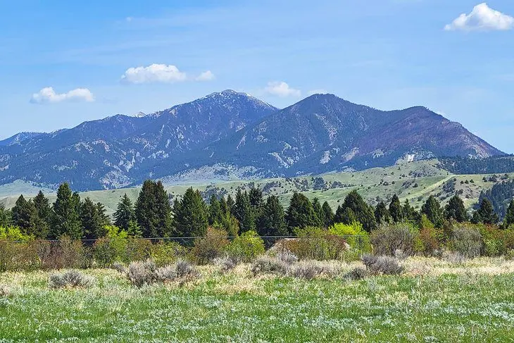
Several routes weave throughout the 41-acre Burke Park. And while there’s plenty of space to explore and get a good hike, the elevated stature of the area makes it hard to get lost. The most extended trek available stretches approximately a mile south to connect with Sourdough Road. The entire area is exposed to the sun, making it a hot hike in the summer.
4. Storm Castle Peak
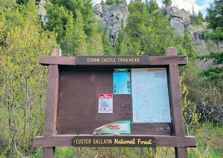
The expansive Custer Gallatin National Forest surrounds all sides of Bozeman, with endless trails to follow. Storm Castle Peak Trail is an iconic route in the forest, accessible from Highway 191 heading south to Big Sky. This relatively short trail doesn’t skimp on elevation gain, with nearly 2,000 feet gained in just over two miles.
But the quick elevation gain pays off upon reaching the top of the 7,170-foot Storm Castle Peak, also known as Castle Rock. This promontory offers extensive views of the Gallatin River Canyon and other surrounding mountains. A unique archway feature at the top is also a popular spot for photographs.
From Four Corners on the west side of Bozeman, it’s approximately a 17-mile drive on Highway 191 to reach Squaw Creek Bridge, which leads to the trailhead. The gate across Squaw Creek Bridge is seasonally open in the spring, summer, and fall. It’s a two-mile drive on a gravel road after crossing the bridge.
Less than a mile farther down Squaw Creek Road, Spire Rock Campground awaits as one of the best campgrounds near Bozeman. This Forest Service campground comprises 19 reservable campsites along the ambling Storm Castle Creek. This proximity to water gives each site a nice sense of privacy with the noise of water nearby.
5. Bear Trap Canyon National Recreation Trail
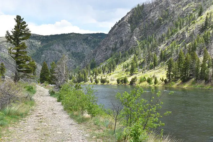
Bear Trap Canyon offers a fantastic hike into the Lee Metcalf Wilderness outside of Bozeman. It’s approximately a 25-mile drive on Highway 84 from Four Corners on the west side of town to reach the trailhead. The last three miles of the drive are on a partially maintained gravel road, accessible to low-clearance vehicles.
The Bear Trap Canyon National Recreation Trail follows the Madison River, one of Montana’s best fly-fishing rivers. As such, expect to see anglers casting some lines along the route. The entire trail spans approximately eight miles along the river, all the way to Ennis Lake. And it’s a relatively flat and incredibly scenic hike the whole length.
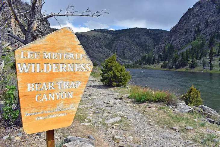
Bear Trap Canyon is popular for trail runners and casual strollers alike thanks to its flat contours and scenic status. Bicycles aren’t allowed because the route navigates through a designated wilderness area. Be aware of fast-moving weather that likes to sneak into the area.
Most visitors do an out-and-back route of their preferred length. A typical spot to aim for and a good turning around point is Bear Trap Creek, approximately 3.5 miles into the trail, making for a seven-mile round trip.
6. South Cottonwood Trail
South Cottonwood Trail is southwest of downtown and is one of many excellent national forest hiking trails close to the city. What makes this hike particularly popular is its lush surroundings and easy access to Cottonwood Creek. The trail is also relatively flat, offering a family-friendly route to follow through the forest.
Most adventures on South Cottonwood extend to the Third Bridge, approximately two miles from the trailhead, for a four-mile out-and-back. The trail extends much farther, however. It stretches six miles to connect with Hyalite Canyon and eight miles to reach the trail for Mount Blackmore.
A shaded forest and running water accompany much of the entire route. This shade and water make the trail pleasant on hot summer days. The trailhead is approximately a 20-minute drive from downtown. And within the first half-mile of hiking, it feels like the city is much farther away.
7. Beehive Basin Trail
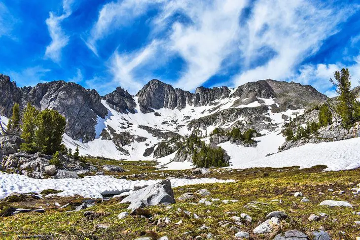
The Beehive Basin Trail is a prime example of the big mountain hiking afforded by the national forest surrounding Bozeman. It’s not only one of Montana’s top hiking trails, but thanks to its alpine postcard landscape, it’s a coveted route sought by hikers from across the country. Expect to share this bucket-list hiking trail with other hikers.
Hikers from Bozeman reach the trailhead with an approximately 50-mile drive south on Highway 191 toward Big Sky. This scenic highway dives deep into the Custer Gallatin National Forest. The hike itself offers stunning views of Lone Peak, home to Big Sky Resort, as well as a sparkling glacier cirque and an alpine lake.
It’s approximately a 6.5-mile round-trip hike to Beehive Basin and back, with 1,500 feet of elevation gain. It’s considered a moderate hike. And ending at an elevation of over 9,600 feet, the route typically induces heavy breathing. It’s recommended to budget four to five hours to make the hike and enjoy the tranquil alpine surroundings. Because of its high elevation, Beehive Basin still has snow well into spring and early summer.
8. Triple Tree Trail
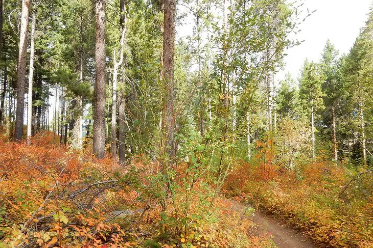
The Triple Tree Trail is a popular local route on the south side of town. The trailhead is accessible on Sourdough Road and is frequented by dog walkers, joggers, and sunset enthusiasts. From the trailhead, it’s a steep climb and a lollipop loop leading to elevated views.
The trail is approximately four miles in total, with over 1,000 feet of elevation gain. Variable lengths are available by turning around at one of the many benches that line the route. But the best views await at the very top, where the vista is just as breathtaking as the climb.
While hikers should avoid the Triple Tree Trail during hot summer midday, the switchbacking route up to the top does have some shade. The trail also crosses Limestone Creek several times initially, offering places to cool off feet or for dogs to get some drinking water.
9. Glen Lake Rotary Park
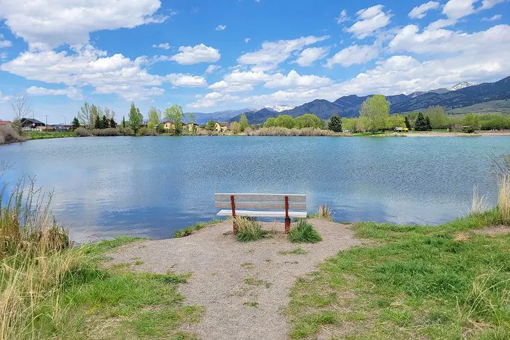
Glen Lake Rotary Park, formerly East Gallatin Recreation Area, is on the north side of town, on the other side of Interstate-90 from downtown. This public park is perhaps best identified by the large lake near its entrance, alongside its sprawling sandy beach. And this area is also home to a family-friendly trail system operated by the Gallatin Valley Land Trust.
The trail system spans northeast from the lake, creating several different loops with places to cross the East Gallatin River. The largest loop possible is approximately three miles long. It’s a relatively flat path the entire way, making this set of trails popular for casual hikes and family outings. The trail also connects with and circles Glen Lake, where hikers are sure to encounter sunbathers and sand volleyball players.
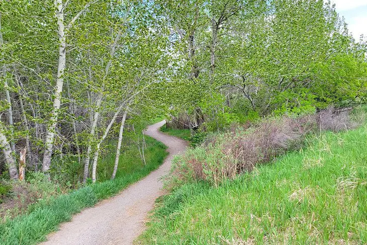
The trail system at Glen Lake connects to the nearby 60-acre Story Mill Park for those looking for a longer hike. Story Mill Park is one of the newest additions to Bozeman’s city parks and features an extra three to four miles of hiking trails.
10. Madison Buffalo Jump State Park
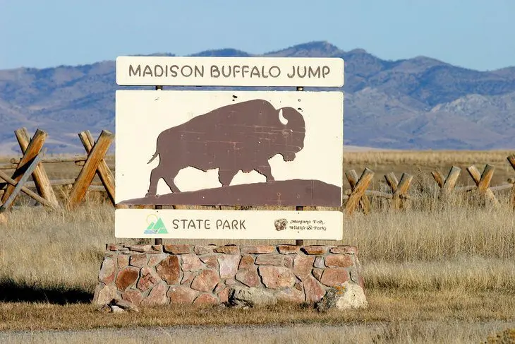
This state park is a 30-mile drive west of Bozeman. It offers a family-friendly hike and insight into native cultures. Archaeological finds at this site suggest the surrounding limestone cliffs served as vital buffalo hunting grounds as long as 2,000 years ago. Specifically, the region’s earliest inhabitants used the rugged outcropping to drive herds of wild buffalo off the cliff.
Today, Madison Buffalo Jump preserves this historical landscape and offers interpretive information detailing the cultural history. The state park also features a small network of hiking trails, including a one-mile route to the cliff overlook. Interpretive information lines the hiking network, including a shaded stone structure with plaques.
The hiking at Madison Buffalo Jump begins in open grasslands and heads to the cliff. Visitors can see the mainstay of the park, including the buffalo jump, with one mile of hiking. Several spur trails make for approximately 3.5 miles of hiking for those looking to stretch their legs more.
Nearly the entire route is exposed to the sun and elements, making for dangerous conditions in the summer. Thanks to this abundant sunshine, however, Madison Buffalo Jump remains a viable hiking opportunity throughout the year, including winter.
Map of Hiking Trails near Bozeman, MT
Best Time to Go Hiking in Bozeman
The hiking season in Bozeman extends throughout the year, but the best time to visit is during the summer, when the weather is warm and the days are the longest. The months of June, July, and August fall into this summer category and are the busiest months on the trails. However, don’t dismiss the shoulder seasons, including May and September.
The biggest downside to hiking in July and August is the occasional heatwave that makes afternoon hikes potentially dangerous. Although temperatures generally average in the low 80s this time of year. Head to higher elevations for cooler temperatures when the heat kicks in. This is also the only time of year when high-elevation routes are free of snow.
Spring in Bozeman, including the month of May, is often beautiful, with a mix of sunshine and rain and maybe the odd snowstorm. Budding interest overtakes the trails this time of year after rainstorms. Similarly, new colors drape across Bozeman starting in September and hit peak autumn tones by October.


