Contents
- 1. Main Beach, MacKerricher State Park
- 2. Pudding Creek Beach
- 3. Jug Handle State Natural Reserve
- 4. Glass Beach
- 5. Seaside Beach
- 6. Hare Creek Beach
- 7. Ten Mile Beach
- 8. Noyo Beach Off-Leash Dog Park
- 9. Westport-Union Landing State Beach
- 10. Caspar Beach
- Where to Stay in Fort Bragg
- Map of Beaches near Fort Bragg, CA
- Fort Bragg, CA – Climate Chart
Stunning beaches surround Fort Bragg on the Northern California coastline. The city is approximately 180 miles north of San Francisco and is the largest coastal city of Mendocino County. For those traveling the Shoreline Highway (Highway 1), it’s a must-stop region for its beaches alone.
Dramatic sea stacks, bluff-top hiking trails, and deep beaches with overhead bridges define the Mendocino County coastline. And thanks to the westward orientation, sunsets often add a brimming color to the mix. Other notable attributes include tide pools, historic train trestles, and tumbled treasures.
And beaches are only a piece of Fort Bragg’s growing tourism appeal. The city is home to the Skunk Train heritage route, where visitors can ride the rails via locomotive or railbike. The Mendocino Coast Botanical Gardens and the ocean-inspired downtown district are other fun places to visit in Fort Bragg.
Find your next ocean getaway with these top beaches near Fort Bragg, California
1. Main Beach, MacKerricher State Park
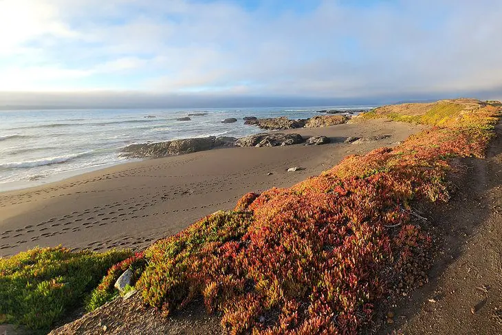
MacKerricher State Park is a coastal gem directly north of Fort Bragg. It encompasses approximately nine miles of shoreline, ranging from craggy bluffs to mile-wide dunes. The mostly paved path known as the Old Haul Road connects many of the state park’s stunning landscapes.
Glass Beach and Pudding Creek Beach bookend MacKerricher to the south, and Ten Mile Beach comprises the northern half of the state park. The Main Beach is near the middle, accessible with a short walk from the state park’s approximately 140 campsites. Spending the night at one of these campsites is the best way to catch the stunning sunsets that touch down on the horizon.
MacKerricher’s Main Beach borders Laguna Point, where a boardwalk leads to a seal-watching station. The beach itself is a rugged slice of shore, with windswept dunes and miles-long views. It’s also a common flyway for marine birds.
MacKerricher is a top spot to enjoy the Mendocino Coast. The Old Haul Road spans the entire park, except for the final 2.7 miles in Ten Mile Beach, removed for environmental rehabilitation. However, traveling the length of this beachfront trail is a must-do experience, either by foot, bicycle, or atop a horse.
2. Pudding Creek Beach
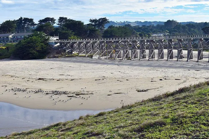
Pudding Creek Beach is on the north side of town and is arguably one of the most scenic stretches of sand in Mendocino County. A historic wooden train trestle spans the tall bluff sides bounding either side of the beach. This photogenic structure has long been a popular pedestrian path, part of the paved Old Haul Road.
There’s a free parking area off Highway 1 to access the beach. Here, visitors cross a small dune system and notoriously squeaky sand underneath the train trestle. It’s a vast and welcoming beach, popular for setting a towel down and enjoying the surf.
The bluffs on either side of the beach are popular to explore. The beach and bluff sides are part of MacKerricher State Park, and several trails allow for beautiful vantage points of the sand. Immediately south, Glass Beach and Noyo Headlands Park offer several coastal scenes ripped right from a postcard.
3. Jug Handle State Natural Reserve
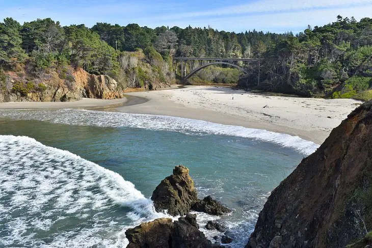
South of Fort Bragg, Jug Handle State Natural Reserve exemplifies all the beauty found on the Mendocino Coast. This coastal reserve has a stunning bluff hiking trail, a bridge-backdropped beach, and a unique pygmy forest. And far enough inland from the ocean, coastal redwoods top off this natural attraction.
The main parking area for the reserve is off Highway 1 on the ocean side of the road. Here, visitors head left toward the bluff trail and right to go down to the beach. It’s not a long walk down to the beach, but it’s steep, and caution should apply. Make it down to the sand, though, and there’s plenty of flat space to explore.
The bluff trail is well worth the excursion above the beach. It provides stellar views of the rocky seashore, including a nearby keyhole formation that makes a big splash. The bluff trail also lends a good look at the beach itself and the Jug Handle Creek Bridge.
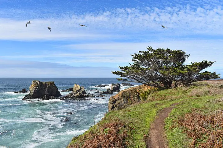
The reserve’s Ecological Staircase starts at the beach by crossing under the bridge. Thousands of years of geology have carved this ancient staircase, and today it offers unique landscape transitions. Here, pygmy forests, bishop pines, and coastal redwoods are encountered along a 2.5-mile path.
4. Glass Beach
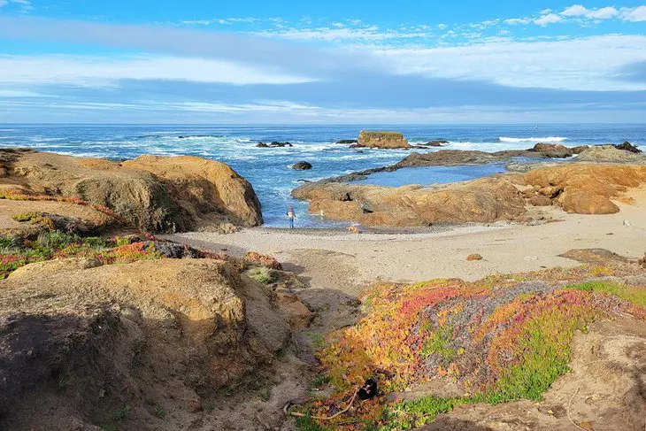
Glass Beach offers a unique mix of human history and the churning power of nature. It’s on the northside of town, at the southern end of MacKerricher State Park. This seaside location was the town’s early trash dump during the first half of the 1900s.
Today, the glass from that refuse has gone through an extensive tumbling process, resulting in a pebbly shoreline freckled with smoothed glass, better known as sea glass. Before Fort Bragg’s Glass Beach was open to the public, these rounded shards dominated the shoreline.
It’s illegal to remove any glass from Glass Beach, but this provision has not prevented the glass from leaving. Today, it takes some searching to find small pockets of brown, green, and white sea glass. But the surrounding coastal area is stunning, regardless of the amount of trash-turned-treasure.
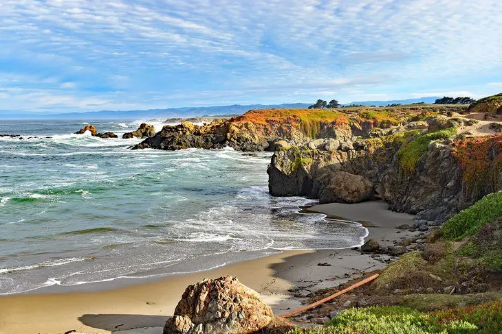
The most common access point to Glass Beach is from Noyo Headlands Park at the north end of downtown. A large parking area on Noyo Point Road accommodates the crowds that tend to gather throughout the week.
5. Seaside Beach
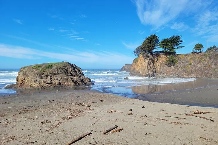
Seaside Beach is 10 miles north of Fort Bragg, right off Highway 1. Its most distinguishing feature is a large rock at the back of the beach that sure-footed visitors can climb for an excellent view. Even without climbing the rock, though, the beach has a great saltwater atmosphere and a semi-rugged coastline to enjoy.
The Mendocino Land Trust owns and manages Seaside Beach. It’s a popular spot throughout the year, although parking is limited to under 10 vehicles. It’s best to carpool if traveling with a group. There are no amenities at the beach, including no potable water or restrooms.
The beach is on the north side of the Ten Mile River. South of the river is Ten Mile Beach and Ten Mile Dunes. This shifting sand expanse is a fun place to visit and a viable option if the Seaside Beach parking area is full. Visitors here will also want to bring their own drinking water.
6. Hare Creek Beach
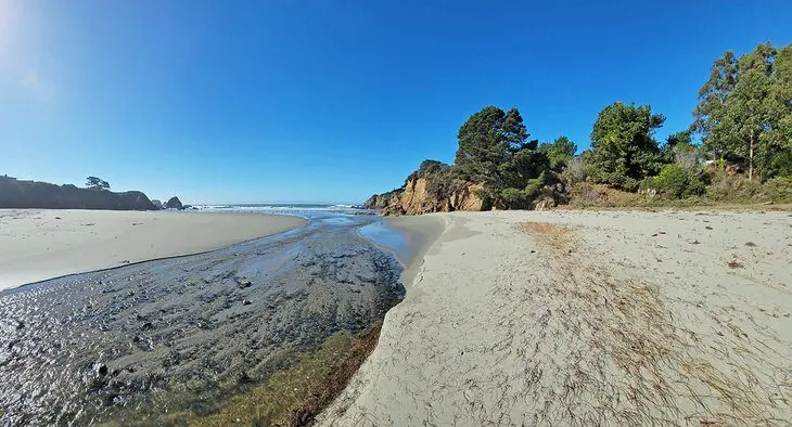
This quiet and scenic beach is on the south side of town, accessible from the back end of the Mendocino College parking lot. The Mendocino Land Trust owns and manages the beach, which is otherwise surrounded by private property. The Land Trust also oversees the 0.6-mile trail leading to the beach, and users are asked to stick to this trail.
The walk to the beach leads next to a flourishing Hare Creek riparian habitat. After emerging from the dense vegetation, the wide-open beach welcomes exploring. And this longer approach usually results in few other people to share the scene with.
Visitors must ford the Hare Creek outlet to explore the entire beach, where water shoes might help. Nice houses surround either bluff side, but the beach is big enough to feel a sense of solitude. Migratory birds often use the sheltered cove, adding wildlife sightings to each visit.
7. Ten Mile Beach
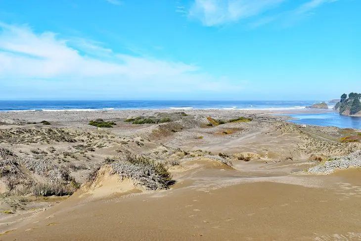
Ten Mile Beach is south of Seaside Beach and the Ten Mile River. It’s within the Inglenook Fen Ten Mile Dunes Natural Preserve, part of the larger MacKerricher State Park. And as its name implies, a massive and moving collection of dunes borders the beach and the ocean. This nearly mile-wide landscape makes the area popular for beachcombers.
Visitors can access Ten Mile Beach from either the northside or southside of the dunes. The southside has a trailhead off Ward Avenue. The northside is accessible off Highway 1 at the end of the Ten Mile River Bridge. Both require a short walk to access the ocean, and traveling across the dunes themselves is a challenge.
Ten Mile Beach is the northern terminus for the state park’s Old Haul Road. In recent years, the park tore out the old pavement to let the landscape act more naturally. Today, the end of Old Haul Road is a shifting route across the dunes.
8. Noyo Beach Off-Leash Dog Park
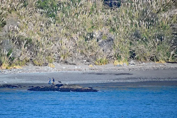
Noyo Headlands Park is a relatively new city space open to the public. It encompasses 3.5 miles of bluff coastline next to downtown, including a paved path lined with benches. The park spans from MacKerricher State Park and Glass Beach to the north, down south to the Noyo River Bridge.
Noyo Beach is next to the Noyo River Bridge and is a favorite for dog owners. Visitors access this off-leash dog area from Highway 1 and a mile drive on Harbor Drive. Upon parking, everyone is free to explore the tidal environments. Dogs should be under voice control at all times while visiting.
9. Westport-Union Landing State Beach
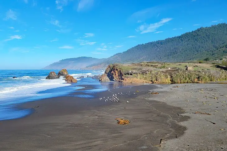
Westport-Union Landing State Beach is a rugged stretch of coast approximately 19 miles north of Fort Bragg. It’s a popular place to visit for its unspoiled beauty and usually less crowded conditions, and it’s a viable option for those looking to spend the night near the ocean, with several campsites available.
Howard Creek bisects the beach at Westport-Union, bordered on either side by plenty of sand. Here, the bridge spanning Highway 1 makes for an excellent photo backdrop. This beach area is also a popular spot for sport anglers looking to net fish.
All 85 campsites at Westport-Union Landing State Beach are available on a first-come, first-served basis and must be paid for with cash or check. Amenities are limited at the campsite, generally consisting of a single exposed picnic table, but the views are unbeatable. Each site is perched atop a small coastal bluff overlooking the ocean. Vault toilets are available to all guests.
10. Caspar Beach
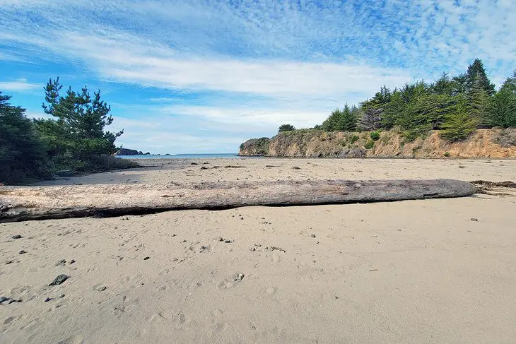
This quieter beach is in the small community of Caspar, about halfway between Fort Bragg and Mendocino. Visitors heading to Point Cabrillo Lighthouse from Fort Bragg pass the beach en route.
Across Point Cabrillo Drive, Caspar Beach RV Park and Campground offers several amenities to add to the beach experience. Their camping selection includes RV sites, tent sites, and cabins. They also offer boat rentals and a convenience store.
A scattering of hiking trails line the bluff to the north, accessible from Caspar Road. South of the beach, Caspar Headlands State Natural Reserve also has hiking trails leading to excellent viewpoints.
Where to Stay in Fort Bragg
To make the most out of sunsets on the ocean, it helps to have a place to spend the night. Camping is available on the coast, but Fort Bragg also has several cozy and comfortable hotels. Check out these top spots in Fort Bragg to spend the night:
- Shoreline Cottages : This popular property is off Highway 1, south of downtown, near Hare Creek Beach. Accommodations include cozy couple’s cottages, family rooms that sleep four, and standard suites for a comfortable stay. The property’s location is ideal, within minutes to several coastline attractions.
- Surf & Sand Lodge : North of downtown, near Pudding Creek Beach and Glass Beach, the Surf & Sand Lodge is a popular choice for couples looking for a romantic vacation. With beach and ocean-view rooms, the sunsets alone set a memorable mood for the evening.
- Emerald Dolphin Inn & Mini Golf : This family-friendly hotel is south of downtown, just past the Noyo River Bridge. Rooms range from cozy queens to king-size suites with Jacuzzis and fireplaces. The 18-hole mini-golf course is a big hit with kids, as well as the property’s indoor arcade and clubhouse.
Map of Beaches near Fort Bragg, CA
Fort Bragg, CA – Climate Chart
| Average minimum and maximum temperatures for Fort Bragg, CA in °C | |||||||||||
| J | F | M | A | M | J | J | A | S | O | N | D |
| 13 5 | 14 6 | 14 6 | 16 6 | 17 7 | 18 9 | 19 10 | 19 10 | 19 9 | 18 8 | 15 6 | 13 4 |
| PlanetWare.com | |||||||||||
| Average monthly precipitation totals for Fort Bragg, CA in mm. | |||||||||||
| 186 | 172 | 165 | 73 | 40 | 11 | 4 | 9 | 19 | 65 | 138 | 161 |
| Average minimum and maximum temperatures for Fort Bragg, CA in °F | |||||||||||
| J | F | M | A | M | J | J | A | S | O | N | D |
| 56 41 | 57 42 | 58 42 | 61 43 | 62 45 | 65 48 | 67 50 | 67 50 | 67 49 | 64 46 | 59 43 | 55 40 |
| PlanetWare.com | |||||||||||
| Average monthly precipitation totals for Fort Bragg, CA in inches. | |||||||||||
| 7.3 | 6.8 | 6.5 | 2.9 | 1.6 | 0.4 | 0.1 | 0.3 | 0.7 | 2.6 | 5.4 | 6.3 |


